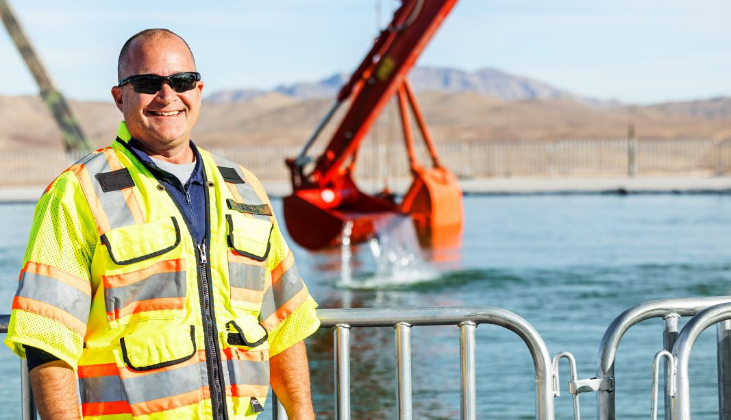
Mike Carris is the sales manager for the marine construction market in the Western hemisphere for Trimble, a company headquartered in Colorado.
As a young Marine and throughout his business career, he has worked with evolving technology for the precise measurement of location. And today, he has the opportunity to share his knowledge and the benefits of precise location with the marine construction industry.
Mike will be the presenter of a webinar presented by Trimble and Marine Construction Magazine on July 31. We asked Mike about his background, his take on the rapid adoption of location data services, and their use in marine work.
MCMag: Most professionals in your position come to it via business, especially sales, or directly from engineering, but your path was a little different.
Mike Carris: I started 34 years ago as an artillery surveyor in the U.S. Marine Corps. That led me into the civilian side of surveying after I left the Corps. I went to school for civil engineering and became an independent consultant who trained engineers, surveyors and contractors on how to implement technology, such as CAD software and surveying equipment. That led me to Trimble 11 years ago. I came on board as a software sales rep, focusing on Trimble Business, Trimble Works Manager and Trimble Works OS, the civil application software for the machine-control industry. Four years ago, I was promoted to a channel performance manager. I went back to school for business, got a degree in business administration and managed the three SITECH distribution dealers on the East Coast. Then, a year ago, I was promoted to the marine construction sales manager for the Americas region.
MCMag: In the scope of marine construction, how important is dredging?
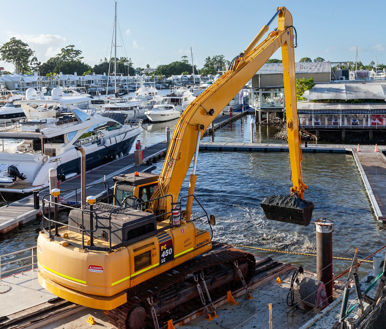
Carris: Dredging is significant, especially in the current state where ships are getting bigger, both container and cruise ships. To accommodate those larger vessels, they have to dredge. And in addition to to the larger ships, erosion and siltation and other aspects of environmental change are affecting everything on the water—from navigable waterways to beachfronts. Everything is affected by the atmosphere and weather, as well as by by the growth of our siting, which has to grow to accommodate bigger ships.
MCMag: Underwater work is the only part of construction that you can’t see with your own eyes, which makes it a prime market for technology.
Carris: That’s right. On the land side of construction, we can look out the cab and see where we’re digging. If an operator misses a section or needs to go deeper, they can see that. But when you’re digging underwater, or driving piles for construction, you can’t see what you’re doing—while you’re doing it—without help.
The other aspect of dredging that ties into it as well is: We can put in erosion control measures on land to protect the grading work, but we can’t control that in the marine environment. A tide or a storm can come in and wipe out all the work we did. Now, you’re back to dredging it again. It’s a unique and always-changing landscape underwater. A lot more challenges, for sure.
MCMag: Would you describe Trimble CenterPoint RTX Marine?
Carris: Well, first of all, let’s talk about GPS. The GPS in your car or truck is going to get you to your address without needing a correction source because it’s not a precise location. Traditionally, the correction source for most land and marine operations is RTK or other sources. You need that correction source to get centimeter-level accuracy. Instead of getting to that address, I can get to a specific point at that address. If you need to get an excavator’s bucket head or a jackhammer attachment to a precise point underwater, you need more precision. You need a correction source to correct for that 10- or 15-foot variance that the GPS on your phone or in your car is giving you.
Traditionally, that correction source is a base station at a known survey point, which most equipment can read with good survey control. The rover or cutter head knows where it’s supposed to be from what the GPS is telling it it’s at and takes the base station broadcast to create a correction. That correction, which is broadcast over radio or internet to the rover or the cutter head, is what provides centimeter-level accuracy.
The problem is that there can be outages. The farther you get away from the baseline, your accuracy degrades. If it’s a radio transmission, you can only get so far out into the water before losing that baseline. If it’s internet, maybe you’re in an area where the cell service isn’t great.
And that’s where CenterPoint RTX shines. It’s a combination of ground stations that transmit their location, timing and atmospheric errors, but instead of sending them by radio, they’re sending them to satellites, and the satellites are giving the corrections back down to the rover, so you don’t have to set up a base station somewhere or deal with a distant line-of-sight. You’re getting the corrections by satellite signal.
All you need is a subscription and you’re getting corrections to centimeters without setting up a base. It changes the game for working in more remote areas and working farther from shore.
MCMag: Watching Trimble over the years, it seems to me that a key to their success is who they’ve partnered with. Trimble does the information systems, but you don’t—for example—make sonar.
How has Trimble acquired and worked with partners?
Carris: We try to harness technologies to create seamless workflows. From the marine side, we’re looking for technological synergy that works with our marine hardware and software. For example, our marine GNSS receivers, the Trimble MPS566 Model 2 modular GNSS heading receiver.
We look at market leaders that complement the areas we work in, such as hydrographic surveying and dredging. Manufacturers of specialized sensors like multi-beam echo sounders from Teledyne and others.
The goal for us on that aspect is to provide contractors with a full solution for tasks like dredging, pile placement and hydrographic surveying. We want to eliminate silos and improve operational control. We want the synergy that connects the digital and physical worlds. One of our mantras is looking at how we take that data and make it useful. We do what we’re good at and we find partners who are good at things like multi- -beam, which we don’t do. There’s no need for us to build that when there are others out there who do a really good job at it. We want to be able to leverage our guidance systems and software technology and partner with others to provide an end solution for the customer.
MCMag: How has Trimble integrated its hardware and software tools from land-based construction to the marine environment?
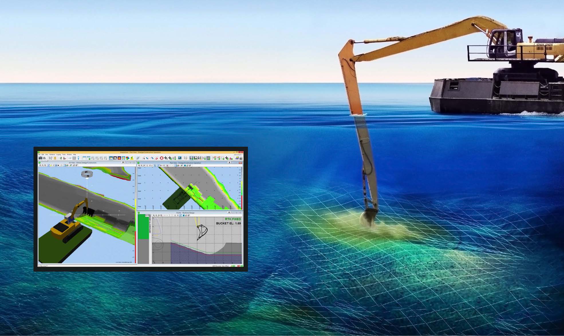
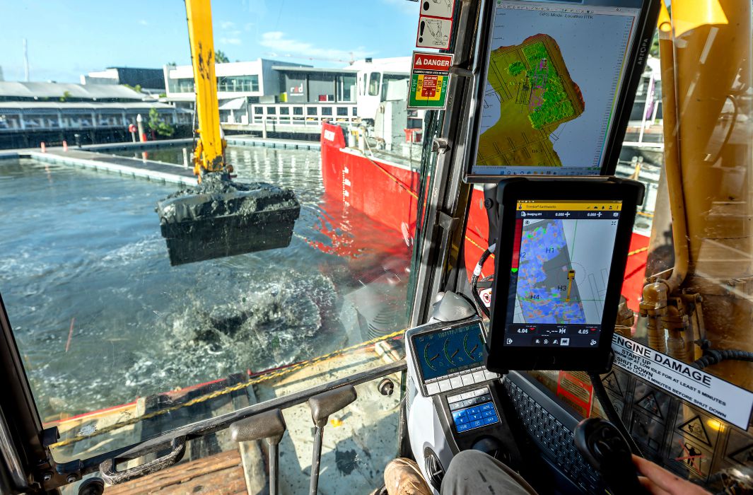
Carris: The GNSS hardware, our receivers and antennas and our main positioning systems are our traditional surveying and earthwork technology for land that we’ve adapted to a marine environment. We can also supplement and adapt our data collection tools. There are instances where we’ve taken a land-based excavator and put an overlay on it so the software is looking at the Trimble Marine Construction [TMC] software instead of Trimble Earthworks software. It’s the same hardware and software we’ve used on land for years, adapted to marine work.
MCMag: There’s probably a lot value to your customers in adapting familiar systems to new uses.
Carris: Contractors who work mostly on land may migrate to some inland work involving water. It might be a marina on a lake or an inland waterway. They might be bidding on a contract where they need to dredge out a marina or commercial port. They may already have Trimble Earthworks systems, so they add TMC as an overlay to give them visibility under the water using similar workflows and practices.
MCMag: What do you like best about your job?
Carris: It’s a combination of all my past experiences—from surveying, civil engineering consulting— that’s led me to the role I’m in today. It’s been an exciting year so far, and I look forward to what we’re going to grow and accomplish in the future.