


By Will Parson
For centuries, the islands of the Chesapeake Bay have been shrinking, the result of land subsidence and erosion, compounded by rising seas. Hundreds of smaller islands have vanished completely. Islands that once supported entire communities— with names like Poplar, Holland, Sharps, James and Barren—have fallen silent. On Fox Island, the Chesapeake Bay Foundation recently closed its long-lived education center.
Today, some Chesapeake islands persist, but face both environmental and economic challenges. Communities of several hundred people live on Smith Island in Maryland and Tangier Island in Virginia, but are shrinking along with eroding shorelines and vanishing economic opportunities. On Deal Island, an aging population of watermen is facing the same pressures.
After withering away, Poplar and Hart-Miller islands served as the first two sites for restoration using sediment dredged from shipping channels. Those massive projects support wildlife, offer recreation opportunities and protect nearby communities from wave action. Soon, an island near the mouth of Maryland’s Little Choptank River, James Island, will be similarly restored.
Kent Mountford, who retired as a senior scientist at the Chesapeake Bay Program in 2000, knows these islands well. He and his wife Nancy moved to Maryland in 1971. Since then, the couple has sailed all over the Chesapeake, logging thousands of miles and hundreds of nights aboard their vessels. Mountford brought a camera loaded with 35mm film and took detailed notes to document their journeys with a scientific eye.
“It was like stepping back to John Smith’s time at one point,” Mountford said. “You could collect artifacts from the original settlements on James Island that dated back to the 1600s.”
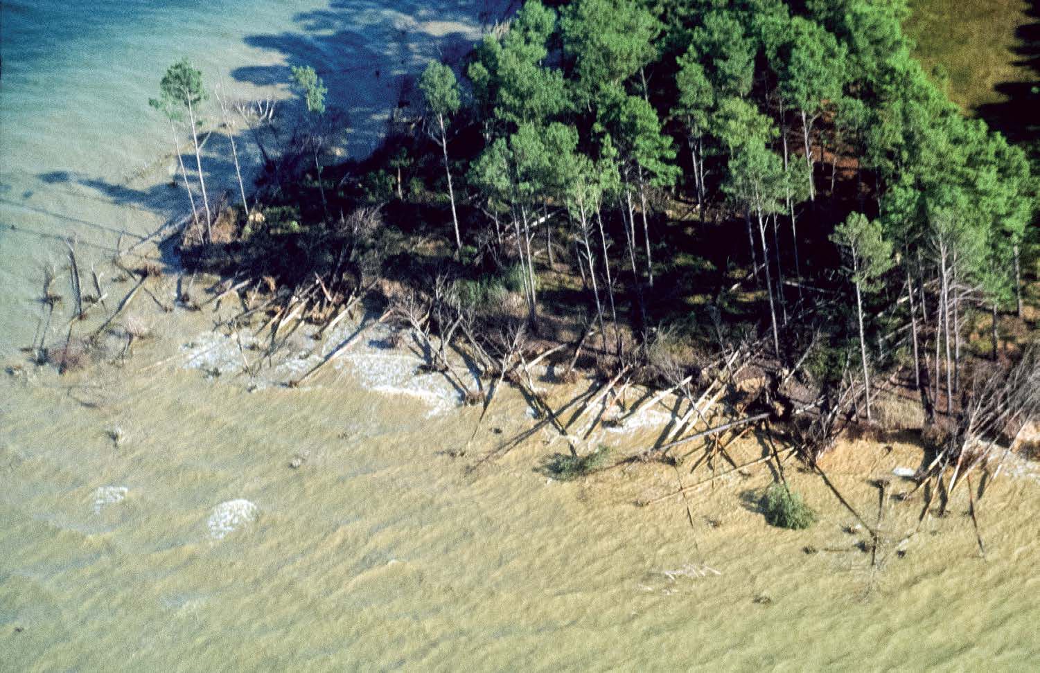
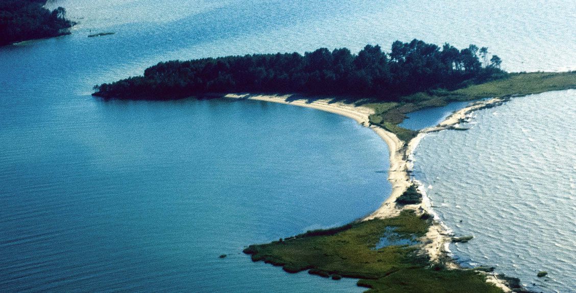
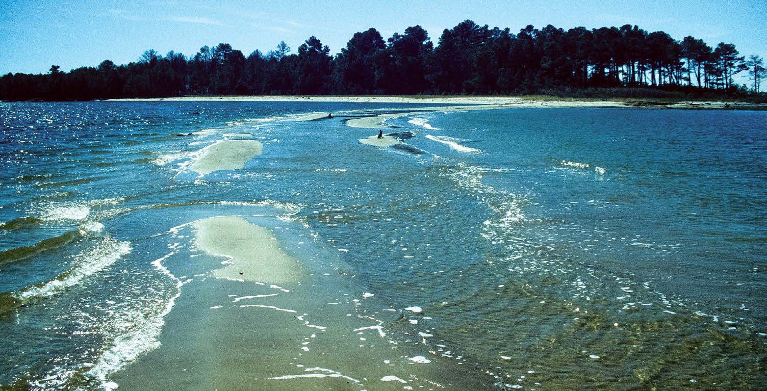
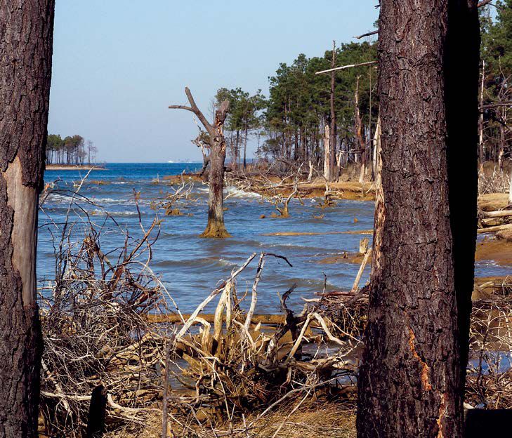
Mountford’s visual record of James Island shows an island eroding away over nearly five decades. The photos show how erosion eventually fragmented the island into three separate parts—South, Middle and North James Island.
“We didn’t really perceive it as an immediate problem because the island was a mile long,” Mountford said.
For some years, a sandbar connected the fragments. “It was really cool,” Mountford said. “You could walk along [the sandbar] and you could do it at high tide when the water was rushing over it, slowly sweeping the sand away. And all the while the perimeter of the island was eroding and trees were falling into the water.”
With a new project on the horizon, James Island’s disappearing act will soon come to an end. The U.S. Army Corps of Engineers and the Maryland Port Administration created a plan to restore the shrinking island as well as nearby Barren Island.
Construction will begin on Barren Island and James Island in 2022 and 2024, respectively, using sediment dredged by the Port of Baltimore.
Once spanning over 1,300 acres when it was settled in the early 1660s, James Island will be restored to nearly 2,100 acres.
Will Parson produces digital stories for the Chesapeake Bay Program. He studied ecology and evolution at University of California, San Diego. He reported on water and the environment as a graduate student at Ohio University’s School of Visual Communication, and worked at newspapers in New England before landing in Maryland.
Republished from Marine Construction Magazine Issue V, 2022


